Friday, March 30, 2012

Gavi, Eco touism Project Pathanamthitta,Kerala

           Gavi Eco-Tourism a project of the Kerala Forest Development Corporation has caught the attention of tourists, mostly from European countries. The project is exclusive in many respects and the majority who visited was nature lovers and adventure tourists. Over a short period of time visitors to Gavi gradually increased, especially after 'Alistair International' the world acclaimed tourism major listed it among the leading eco-tourism centres and one of the must-see places in India.

           A highlight of the Gavi eco project is the involvement of the local populace in its activities as guides, gardeners and cooks. This will provide livelihood for the locals and also will help to create awareness on conservation of nature. Gavi, located in Pathanamthitta district offers its visitors activities like trekking, wildlife watching, outdoor camping in specially built tents, and night safaris.

           The road leading to the picturesque Gavi is blanketed by tea plantations, which itself is a refreshing experience. En route to Gavi are places of interest like Mundakayyam, Kuttikanam, Peermedu and Vandiperiyar from where the road deviates to Gavi.


           Once you reach Gavi the serene eco-lodge 'Green Mansion' awaits you like a fairy to embrace you in its protective fold. From the 'Green Mansion', one can savour the spectacular view of the Gavi Lake and the adjoining forests. Besides the accommodation provided in 'Green Mansion' visitors can also try out the tree houses here and can even pitch tents amidst the wilderness. Here one can have outstanding trekking experiences, which are overseen by trained local people. Those who would love to be left alone can do so in the tranquil environs of Gavi or may even go canoeing in the placid waters of the lake or enjoy a breathtaking sunset. Visitors are usually provided vegetarian food and snacks, which further adds to the eco-friendly ambiance of the place.

           The place is rich in flora and fauna. There are hills and valleys, tropical forests, sprawling grasslands, sholas, cascading waterfalls and cardamom plantations. Endangered species including the Nilgiri Tahr and Lion-tailed macaque are often sighted at the outskirts of Gavi. With more than 260 species of birds including the great pied hornbill, woodpecker, and kingfishers, Gavi is a heaven for birdwatchers.


            Some of the breathtaking viewpoints at Gavi like the Valley View offer spectacular view of a deep ravine and the forest below. From Kochu Pampa, a point near Green Mansion eco-lodge one can track the grazing Nilgiri Tahrs.

           The famous pilgrim destination, Sabarimala is a short trek from Gavi. For those interested in observing the nocturnal wildlife, night safaris to Kullur, Gavi Pullumedu, Kochu Pampa, Pachakanam provide ample opportunities for wildlife viewing.

           Another unique feature of Gavi is camping in the forests. One can pitch a tent in the camping site, which is a rarity in many Indian forests. As the dusk stretches into the silence of the night, one can feel the presence of wildlife in the middle of nowhere, an experience that cannot be explained in words. There are also tree top houses where one can enjoy the avian life to the fullest.

           Active involvement of tribals in Gavi makes it a unique venture of its kind in the country. Traditional knowledge of the forest and its way of life helps Gavi to sustain its surroundings in its original state. 
          Gavi is bound to cast its magical spell on every visitor and is surely a place that should not be missed in one's lifetime. Gavi is pristine, and it belongs to the wild, which is a reminder that visitors are responsible for their intentions and actions, which will have a bearing on the upkeep of Gavi for a long time to come.

Location:
Gavi is located about 28 km from Vandiperiyar, which is 18 km from Thekkady.
Nearest railway station: Kottayam, about 114 km away.
Nearest airports: Madurai Airport (Tamil Nadu), about 140 km away; Cochin International Airport, about 190 km away.

Contact AddressPeriyar Tiger Reserve.
Eco-Tourism Project Periyar.

For more details please contact:
Tourist Information Office
Department of Tourism, Thekkady
Phone: 04869-222620

Saturday, March 24, 2012

Mankayam falls


Close to the Capital City of Thiruvananthapuram is Mankayam, situated near Palode in Nedumangad Taluk. This water spectacle can be enjoyed at any time of the year. Mankayam was recently launched as a zone for ecotourism, managed by the State Forest Department.

At the Mankayam ecotourism zone, visitors can seek the assistance of guides with the entire activities coordinated by the Vanasamrakshna Samithi (Forest Protection Group), working under the forest department of the State.

Rising from the hill ranges of Chemunchi, the River Chittar, flowing down through the forests of Brymore creates a tributary in the form of Mankayam River. The Mankayam River in its course further down, produces two spectacular waterfalls. One is at Kalakayam, which is one of the biggest waterfalls in the area and the other at Kurissadi. The spectacular falls at Kalakayam and Kurisadi can be seen and enjoyed from view points provided by authorities. The Kurisadi Ghat offers an excellent spot for bathing.
With rich forest setting, the area in and around the waterfalls are overwhelmingly green. Shrubs to gigantic and lofty trees of evergreen and semi-evergreen grasslands are found here.
From Mankayam, visitors can go to nearby picturesque spots and can also go for trekking. An interior area trek here, covering Iruthala Moola - Ayampara is a half day trek, which also would enable one to witness the Ayampara waterfalls and some of the wildlife in the area. Adventure inclined visitors may opt for the one day Mankayam - Varayadin Mottai trek. This trek would take one through rolling valleys, grasslands and shola forests. You would also come across the endangered Nilgiri Tahr; a species of wild goat, at the peak of Varayadin Mottai. Camping options are available here along with trained guides.


Mankayam is situated at Idinjar Falls in Palode in Nedumangad Taluk of Thiruvananthapuram District. The Mankayam River, a tributary of Chittar, flows through this scenic tourist spot. Situated at an elevation of around 500 m above sea level, the fertile soil here has yielded lush foliage that houses interesting species of flora. The entire area from Mankayam to Kalakkayam covers a long stretch of forest vegetation on the banks of the Mankayam River. The undulating terrain with rocky patches shelters the Kalakkayam Waterfall, one of the biggest falls in this area.
Ecotourism Activities
Visits to picturesque spots and treks ranging from soft to hard adventure are possible here. The ecotourism zone extending from Mankayam to Kurisadi is about 1 km and covered with luxuriant vegetation of diverse forest types. Shrubs to gigantic and lofty trees of evergreen and semi-evergreen grasslands are found here. Just 20 m from the main road is the Kurisadi Ghat which is an excellent spot for bathing.
Kalakkayam-Kurisadi Falls
These delightful falls can be seen and enjoyed only from the view point provided with all security measures. Approach roads close to the waterfall is dangerous and visitors are not allowed to go near it.

Trekking TrailsThe following paths are excellent for soft, medium and adventure trekking.
Interior Area Treks - Iruthala Moola-Ayampara - a half day trek where visitors can see Ayampara Waterfalls and a variety of wildlife.
Adventure Trekking - Mankayam-Varayadin Mottai - one day trek taking in the panoramic view of rolling valleys, grasslands and shola forests. The Peak is famous for the Nilgiri tahr, the endangered species of wild goats. Camping facilities are provided at Varayadin Mottai in machans. Camp equipment, kits etc. will be arranged as also trained guides, to accompany the tourists during the tour

For enquiries and bookings,contact:
Divisional Forest Office, Thiruvananthapuram, Ph: 0471-2320637
District Tourism Promotion Council Office, Thiruvananthapuram Ph: 0471-2315397

Getting there
Nearest airport: Thiruvananthapuram International Airport, about 55 kms.
Nearest railway station: Thiruvanathapuram Central, about 45 kms.

Paniyeli Poru

Paniyeli Poru is in Ernakulam District of Kerala state in India. Its an amazing sight of Periyar river flowing thorugh rocks and between dense rain forests. The vast view of distant green hillocks and the tranquility around the place is really great.

The name ‘Poru’ ( means fight in Malayalam) was derived from the old custom of raftsmen fighting with the unruly waves, deep vortex, to sail out from the area. The raft forms after bamboo cut from the ‘Edamalayar’ forest, tied as logs. It was the old practice of bamboo cutters, to carry logs to destination like ‘Kalady’ & ‘Malayattoor’, through river ‘Periyar’. Only an experienced raftsman could sail the log through the unruly water here. The area, where the rafts man fights fiercely against these adversities, was later called by ‘Poru’. Now a days logs of bamboo cut from the forest are carried away through the road in Vehicles.
‘Poru’ came in to the limelight of tourist map lately. The crowds began in 2000-01. Heavy rush of tourist appear on saturdays, sundays and Public holidays.During Summer season in March -April, people in large number throng here to escape from the hot, sweat condition. A bathe in fresh, crystal clear water of ‘periyar’ makes your body and mind warm and fresh. Beware about the death trap between the strata of rocks connecting mangroves, existing in the the river belt. Do not immerse in deep and farther water. Don’t step in to water after consuming liquor. The rocks in between the mangroves is slippery due to the in flow of gushy dam water and rain. Normally, the concerned department announce in advance, the opening of shutters of ‘Edamalayar’ and ‘Idukki’ dams.


Mid November to End of May is the good time to visit as the water flow will be reduced during this time thus exposing the rocks and whirlpools. For adventurous travellers, a little known picnic spot, on the outskirts of kochi, awaits you. ‘Paniyeli Poru’, near Vengoor, Perumbavoor, has natural water falls, small rivulets, offshore surrounded by rich flora and fauna, where the visitors can rest etc. There are no restrictions, but the visitors must be cautious. The strong water currents and deep vortex formed between the strata of rocks and mangroves can be dangerous. Youths in inebriated condition had fallen here fatally. Beware about the strong under currents, before stepping into the water.The slippery rocks and pebbles may lead to danger. Nearly 150 youths have died here during the last one decade. The latest casualty being the death of a girl student on November 5,2005. It is the first, incident, in which a female tourist lost her life here. Resting, by sitting on the offshore surrounded by dense trees, is a unique experience. The sweet, melodious sound of birds, the bustling sound of water waves makes your heart, mind and body cheerful. The river ‘Periyar’ flowing in between two main lands ‘Malayattoor’ in the north and ‘Paniyeli’ in the south, provides a Panoramic view to the visitors. The hilly terrain of St: Thomas mount, western Ghats, the famous kraal at Kodanad etc. forms part of ‘Paniyeli Poru’.


Get in
Paniyeli Poru is 55 kilometres from Kochi. The nearest railway station is Aluva that is 35 km from this place. Poru is 20 km away from Perumbavoor, the nearest town. From here take a left deviation from the MGM School Junction, Kuruppumpady, on the busy Aluva-Munnar (AM Road) road. There are bus services from Perumbavoor to Paniyeli on half-hour duration. One has to walk at least a kilometre to Poru after alighting the bus at Paniyeli. Jeeps and motorcycles can take you up to Poru. The roads to Poru are not tarred and in very bad shape. It is better to leave the cars and scooters and trek all the way.

Get around
Although the dense forest on the shore of ‘Periyar’ is devoid of wild animals, deer, pig, and python can be seldom seen. Leeches are also rampant along the pathway leading to ‘Poru’. The milky waterfall at ‘poru’can be seen from the distant shore. It is risky to reach there by crossing over the strata of rocks and mangroves. Even during hot summer, when water level falls, it is dangerous to cross over the strata of rocks, unless vigilant. It is advisable to enjoy the beauty of water bursting, by sitting on the shore. Even if the water level is below buttock level, the gap between the rocks may be slippery and fathom. Even a good swimmer cannot with stand and tide out of the strong water currents here.
There is no organised rescue system in ‘poru’ now. It is the locals who come into the rescue of those who fell into trap. The visitor some times, under estimate the tranquil of water in the surface. A little distance away from the off shore is advisable for swim and bathe. Even though, the water level may be buttock bottom, the fathom can be dangerous. Many have fallen here fatally after hitting on rocks, while slipping away.
The nearest fire and rescue service is at Perumbavoor, 20km away from ‘Poru’. More over, the fire force is not equipped with the rescue operation of this type. Those who slip away in the water currents, cannot be saved by the traditional away of rescue operation carried out by the Fire force. Dwellings, a little in number are situated 1-2 km away from the water falls.

Aralam Wildlife Sanctuary

Aralam Wildlife Sanctuary


Aralam wildlife sanctuary is the northernmost protected area of Kerala state, situated in the southeast part of Kannur District. It lies between 11° 54 and 11° 59  North latitude and 75° 47  and 75° 57 East longitude.
The sanctuary area falls in Aralam, Kelakam and Kottiyoor revenue villages and is located in the Northwest slopes of Western Ghats contiguous with the forests of Coorg (Kodagu) district of Karnataka state.
The PA (Protected Area) is comprised of Aralam Range, the only Range of Aralam wildlife division, which is part of Northern Wildlife Circle (Northern Region) Palakkad. The extent of the sanctuary is 55 km2 .

The sanctuary was constituted in the year 1984 as per GO (P) 300/84/AD dated 15-10-84.
It was formed by carving out areas from the Odanthode Malavaram of Thalassery special division which was an erstwhile private forest, subsequently taken over by Govt. as per the provisions of the Kerala Private Forests (Vesting and assignment) Act 1971 and from the Kottiyoor RF of Wayanad Forest Division.
The Vested Forest portion of the sanctuary is 32.64 km2 and the 22.36 km2 is part of Kottiyoor RF (Reserved Forest).


Till 30.6.98 this sanctuary was a Range in Wayanad Wildlife Division. It started functioning as an independent wildlife division since 1.7.98 as per GO (MS) 36/98 dated 27.5.98.
In the First Management Plan the entire area was divided in to two zones viz: the Core Zone and the Buffer Zone.
The Aralam Sanctuary is spread over 55 sq km of undulating forested highlands on the slopes of the Western Ghats. The highest peak here - Katti Betta - rises to a majestic 1145 m above sea level.
Covered with tropical and semi evergreen forests, the Aralam Sanctuary is home to a vast variety of flora and fauna endemic to the Western Ghats. Elephant, gaur, sambar, spotted deer, barking deer, Nilgiri langur, Hanuman langur, Malabar giant squirrel, etc can be seen here.
Aralam, a village in Thalasserry, is also noted for the Central State Farm, a 3060 hectare farm started in 1971 by the Government of India. This is one of the main production centres of hybrid coconut seeds in the country.


Getting there:
Nearest railway station:  Thalasserry, about 35 km.
Nearest airport:  Karipur International Airport, Kozhikode about 71 km from Thalasserry town.

Situation:Northern most protected area of Kerala and situated in South east Kannur District.
Location:
Latitude 110 541 and 110 591 North Longitude 750 471 and 750 871 East

Wednesday, March 21, 2012

Chimmini Wildlife Sanctuary

Chimmini Wildlife Sanctuary

Chimmini Wildlife Sanctuary is located in the western valley of Nelliampathy in the Mukundapuram taluk, the Thrissur district of Kerala. Some part of this sanctuary is located near the Peechi – Vazhani sanctuary and the rest of the part is located near the Parambikulam sanctuary. An artificial lake has been formed here by the dam across the Chimmini River. The Chimmini Wildlife sanctuary was established in 1984 and occupies the watershed areas of the Kunumali and Mupliyam rivers and is encircled by the hills. This wildlife sanctuary covers an area of 75 square km and the lake covers an area of 10 square km. The vegetation here comprises of the evergreen forests, semi evergreen forests and the leaf shedding trees. The highest point, the Punda peak (1116 m) is located on the eastern side of the Chimmini Wildlife Sanctuary. There are also various trekking trail paths up the rocks and into the forests of the sanctuary.

 
Wildlife attractions in the Chimmini Wildlife SanctuarySome of the wildlife animals found in the Chimmini Wildlife Sanctuary are Leopard, elephant, bear, wild pig, wild bison, tiger etc.

Vegetation in Chimmini Wildlife Sanctuary
Palai, Punna, Vediplavu, Kalpine, Anjili, White Pine, Thampakom, White Akil, Pathri, Nedunar are the evergreen forests found in the upper part and trees like Vetti, Thetti, Kara, Narakom, Marotti, Cheru, Mullilavu, etc. are found in the lower parts. Manja Kadambu, Ayani, Elavu, Pongu, White teak, Manimaruthu, Kanakkaitha, Vakkaplavu are some of the semi-evergreen forests found in the Chimmini Wildlife Sanctuary.
Some interesting facts:

Latitude and Longitude: 10 degree 22' - 10 degree 26' North and 76 degree 31' - 76 degree 37' East
Area: 75 square kms.
Altitude: 40 m - 1116 m above sea level.
Rainfall: 2980 mm
Tourist season: December to April
Temperature: 24 to 36 Degree Celsius in summers and upto 15 Degree Celsius in winters


How to reach Chimmini Wildlife Sanctuary
By Air:

The nearest airport is located at Kochi (Cochin) which is about 50 kms.

By Rail:
The nearest railway station is located at Thrissur, about 35 kms.

By Road:
This wildlife sanctuary can be easily reached by Amballoor (12 km), located on the Ernakulam – Thrissur road.


RHODOVALLEY

Rhodovalley, named so because of the abundance of rhododendrons found here is one of the most spectacular spots in the Munnar hills. The beautiful shola-grasslands of the 'Silent Valley' plateau in Munnar at altitudes over 2,000 metres, sheltering highly endangered species of wildlife are ideal for adventures. A great way to enjoy the landscape is to trek through the various trails that crisscross these mountain paths. The cool mountain air, lush grasslands, gushing streams and the blooming rhododendrons all add to the experience.


Ecotourism Activities
                    The Rhodovalley ecotourism packages are based on fixed tariffs. Programme is free for children below 5 years.

Trekking Camps:
                  Starting at the Silent Valley Tea Estate, the trek halts at the Rhododendron Valley Camp, the Land's End Camp and the Lake View Camp.

Back Home to Wilderness Camps (2 days) - Trek from the Silent Valley Estate to a forest hut in approximately 2 hours. Next day, through the valley of rhododendrons to Meesapulimala and then hike down to Silent Valley by evening.

Back Home to Wilderness Camps (3 days) - Trek from Silent Valley to Land's End Camp. Next day, climb to Meesapulimala and then back again to the Rhodovalley campsite. Third day, proceed back to Silent Valley.

Back Home to Wilderness Camps (Kadalar Trek) - Trek from Rajamalai, home of the endangered Nilgiri tahr through thick shola forests to the Orchidarium site at Kadalar. Overnight stay at the camp and return by jeep the next morning to Munnar.


In and Around
Orchidarium and flower garden adjacent to the KFDC Office on Mattupetty Road. For those interested in seeing the orchid farm at Kadalar, a special nature tour involving a jeep journey and trek to the forests at Kadalar, is available. Mattupetty Dam, Lockhart Gap, Kundala and Devikulam Lakes are other attractions in the vicinity.

Accommodation:
              Dormitory facility is available near the KFDC Office at Munnar. Visitors can also opt to stay at the various resorts in and around Munnar.

Location:
 Perched at 6,000 ft in the Western Ghats at the confluence of three rivers. Adjacent to it is Anamudi, which at 8,841 ft is the highest peak in South India.

Distance:
Air: Nearest airport is Cochin International Airport, 121 km away.
Rail: The nearest railhead is Aluva, but the Ernakulam Junction station is better connected to other cities.
Road: NH 49 links Kochi to Munnar. Aluva is about 120 km while Palakkad is 150 km away.

For enquiries and bookings, contact:

Kerala Forest Development Corporation, Kottayam, Ph: 0481-2581204. mail@keralafdc.org
District Tourist Promotion Council Office
Idukki, Ph: 0486-2232248
Munnar, Ph: 04865-231516


Saturday, March 17, 2012

Thommankuthu Waterfalls

Thommankuthu Waterfalls


If you are a nature lover or an adventure seeker, Thommankuthu is just the right place in Kerala. 20 km away from Thodupuzha, this site draws the attention of several tourists. The exhilarating beauty of Thommankuthu waterfalls captures the heart and soul of every traveler.Thommankuthu waterfalls are another marvelous wonder of the nature, If you are a nature lover or an adventure seeker then Thommankuthu is just for you.

Thommankuthu waterfall is a beautiful seven-step waterfall offering salubrious weather. Amidst verdure foliage, this shimmering waterfall is a perfect place to spend time in the lap of nature. Thommankuthu waterfall tours will allow tourist to savor the wild beauty of forest and stream. Tours to Thommankuthu Waterfalls in Kerala with Kerala Travel Tourism truly has something for everyone. If you are looking for an adventurous vacation, Thommankuthu waterfall tours offer all the adventure you can handle.


This exotic place is congenial for trekking or mountain climbing. Tourists looking for adventure can trek the mountain, which is around 12 km of climbing. Since there are no accommodation facilities available at this site, tourists can enjoy only one-day tours. Tourists can also enjoy boating on the lake. Fishing and horse riding are other options available in this pleasant valley.

This is a seven step waterfall and is a much loved picnic spot. At each step there is a cascade and a pool beneath. Thommankuthu is an ideal place for adventure tourism. This idyllic hill station with its velvet lawns, exotic flora and fauna and the cool mountain air is a rare experience. The wilderness of the jungle awaits you with its untouched and untainted beauty.


Thommankuthu has an interesting legend which makes it as famous as its stunning waterfalls. These falls are a sight to be seen and experienced. It offers you a peaceful place to unwind and explore the unknown. Thommankuthu lies in the deep forest of the Idukki district. Though the general climate of Thommankuthu is tropical the jungle has a cool and airy atmosphere. You will find wet evergreen forests which are storehouse of medicinal plants and there are about 180 species and these are many wild relatives of the cultivated plants.

Monday, March 12, 2012

Palaruvi Waterfall, Kollam

Palaruvi Waterfall, Kollam

One of the most resplendent waterfalls located in an eco tourism location in Kollam District, the Palaruvi waterfall is managed by the Palaruvi Vana Samrakhana Samithi (VSS) under the Thenmala Forest Development Agency. The falls, which is a memorable experience, is visited by one lakh people every year. The VSS provides typical Kerala food using spices of Arienkavu valley. Facilities for trekking to evergreen forests and to sandal trees bearing forests are also available.

Palaruvi - literally, stream of milk - is one of Kerala's most picturesque waterfalls, cascading down a height of 300 feet. It is a favourite picnic spot for visitors from all over south India. The journey to Palaruvi through the dense tropical forest is a spellbinding experience.
Palaruvi which means stream of milk makes its way down the rocks, from a height of 300 feet. It is a beautiful picnic spot.
The surrounding mist-clad blue hills and green valleys form a stunning backdrop to the milk-white burst of foam whose muffled roar resounds through the otherwise tranquil virgin forest.


Palaruvi is around 4 km deep into the forest from the NH 208.It is situated in and around the Thenmala Eco Tourism Project. Areas marvelous for evergreen forests and temples of Lord Ayyappa. In kulathupuzha the fresh water swamps, harbouring fishes, are ideal bathing ghats. The temple at Kulathupuzha, Aryankavu, and Achencoil, attracts many devotees. The perennial waterfall at Palaruvi, near Aryankavu attracts a lot of visitors.
Palaruvi Falls is one of those waterfalls that apparently have ayurvedic healing properties as we were told the stream meanders through some natural herbal groves further upstream. To make it easier for visitors to get the benefit of these ayurvedic properties by bathing in the waterfall's waters, we noticed there were changing rooms as well as designated gender-separated bathing areas in the stream.


Location:
About 75 km from Kollam on the Kollam - Shencottah road.
Nearest railway station: Kollam about 75 km.
Nearest airport: Thiruvananthapuram International Airport, about 72 km from Kollam town.

Sunday, March 11, 2012

Thenmala Ecotourism

Thenmala, India's first planned ecotourism destinaton located about 72kms from Thiruvananthapuram, the State Capital of Kerala, God's Own Country, the southern most State of India, and around 67 kilometers from Kollam city . Thenmala is a small village at the foothills of Western Ghats and predominantly a forest area. The famous Shenduruney Wildlife Sanctuary is the most important ecotourism resource of Thenmala Ecotourism. This Wildlife Sanctuary is of about 100 sq. km. and harbors large varieties of flora and fauna.


Thenmala : "Then + Mala" , i.e. in local parlance "Then" means honey and "Mala" means hillock i.e. it mean honey hills. The honey collected from Thenmala forest region is of good quality and of high medicinal value because of the unique floristic composition of the forests.


Thenmala is tourist attraction in punalur .the name came from the word “then” which means honey and “mala” means hill that is honey hills .Thenmala is the first ecotourism project in the country. Thenmala attracts tourist from inside and outside the country with a series of attractions.
Thenmala dam is most prominent attraction of thenmala. Built on Kallada River it is the second largest irrigation project in the country. Boating in the reservoir is another attraction. Boating through such exquisite wild life is so peaceful, which is a getaway for people who are so busy in their life.

Tourism Department, Government of Kerala, India has taken steps to give focussed attention to ecotourism in the State. A separate ecotourism wing has been created to give policy support for the development of the ecotourism destinations in the State. Accordingly a project for the first planned ecotourism destination (Thenmala Ecotourism Project) has been formulated in and around Shenduruney Wildlife Sanctuary with the co-operation of departments such as Forest, Irrigation and Tourism. In order to give flexibility in management for the development of this destination, a separate Society, the Thenmala Ecotourism Promotion Society (TEPS) has been constituted.

"Thenmala Ecotourism" has been conceived as a first planned ecotourism destination in India and the initial stages of implementation is completed


The major objectives of this project are
1. To develop Thenmala dam and its surroundings as a major tourist destination.
2. To promote Ecotourism on the basis of sound principles of ecological sustainability in the surrounding areas of Thenmala.
3. To have a well planned tourism destination with emphasis on sustainable tourism development so as to become a model for other destination development programmes.
When the idea of developing Thenmala as a tourism destination was mooted seriously in 1996, it was decided to develop it as an ecotourism destination by keeping the degraded forest area, in the outskirts of the Sanctuary, as a familiarization zone. The studies and discussions followed helped to evolve a strategy to control the mass tourism within the outer limits of the Sanctuary. Hence the ecotourism products, which are developed within Sanctuary, are expected to be supply driven, which eventually takes care of ecological sustainability. It was also planned to have satellite centers in various places in Western Ghats mountainous region within a radius of 50 km from Thenmala. The familiarisation zones thus created function as area for soft ecotourists.
Eco-friendly General Tourism is planned in the periphery of the sanctuary so that pressure of tourism will not affect sanctuary. The real ecotourism is to take place in sanctuary and only ecotourists are encouraged for that. Others can experience the ecofriendly products such as small nature trails, elevated walkway through canopies, mountain biking etc. This will give them a feeling of what awaits as ecotourism in the sanctuary area, for which they have to wait since it is supply driven. This was a consciously developed management strategy after analysing what is happening in various sanctuaries by way of tourist pressure.
Facilities such as boating in the Sanctuary reservoir, boardwalk, sculpture garden, amphitheatre, Musical Dancing Fountain, etc. are also provided at Thenmala for soft ecotourists. An Environmental education and interpretation center is also being set up at Thenmala.
Thenmala Ecotourism Promotion Society adopted a strategy to co-ordinate with Forest Department, the Irrigation Department and Tourism Department and implement various activities in association with each Department.
Private initiative is expected in areas such as providing accommodation, transportation facility etc. No permanent constructions are made in forest areas. Accommodations for tourists are developed outside the forests, at a distance.
To make this project a great success Thenmala Ecotourism Promotion Society (TEPS) entrusted the conduct of Environmental Impact Assessment (EIA) to Kerala Forest Research Institute (KFRI). KFRI had conducted EIA for the destination and the satellite spots. Further, on the recommendations of KFRI and on the basis of the Environmental Impact Assessment, TEPS amended the activities so as to minimise the negative impacts of the project.
The products such as trekking, bird watching trails etc. is being developed and operationalised through the institution of Eco-development Committees / Participatory Forest Management Committees (locally known as Vana Samrakshna Samithi (VSS)), thereby ensuring local benefits from ecotourism. Forest Department has already evolved expertise in the formulation of Eco-development Committees and VSS through institutionalised means. This will help in channelising the benefits of ecotourism to the local people, which will ultimately elicit support of local community for forest protection and conservation.
Thenmala ecotourism project is the first planned ecotourism project/destination in the country. In many other cases it was just renaming of an already existing "nature tourism". Here from the very beginning efforts have been taken to imbibe the internationally accepted principles of ecotourism in the planning process as well as in implementation. A conscious management strategy has been evolved to create a familiarization zone to limit the impacts in sensitive ecosystems to the minimum. Another important feature is the institutionalizing of co-ordination mechanism among Forests, Irrigation and Tourism Departments, Local Community, Local Self Government and other stake holders.
In short "Thenmala ecotourism" is a learning experience. Our idea is to make this destination qualitatively better by getting valuable feedback from all esteemed visitors and there by strive for excellence in the area of conservation of natural resources and authentic tourism experience.

Kodanadu Elephant training centre

Kodanad, the head quarters of Malayattur forest division, is known for the ‘Elephant Kraal’ and is about 45 km from Ernakulam (Cochin or Kochi) and 12 km to the east of Perumbavoor town. From the Cochin International Airport you travel to Kalady and from there to Perumbavoor. Before you reach Perumbavoor, you turn left and travel about 5 kilometers to reach Kodanad, the elephant training center. Kodanad is also an orphanage: The total number of orphaned babies in the Kodanad center is ten of which four are male babies and six females. Be there at 8 o'clock in the morning. You can stay at Thani Illam in Thottuva near Kodanad.


Before 1977, elephants were captured from the nearby Malayattoor forests and trained at Kodanad. Capture of elephants was banned in that year and Kodanad center does not engage in capturing elephants any more. The Kodanad center now focuses on training elephants.
Activities with Elephants

Elephant bathe
In the mornings at the riverside, tourists informally get a chance to experience hands-on bathe and massage of adult and baby elephants under the supervision of its Mahouts. Bathe and massage of elephants are normally done with small flat rocks, and husk of coconuts

Elephant Safari
Kodanad offers elephant safari to the visitors at the main park. At the park, the old 'Kraal' is maintained to house elephants, which is a structure made of wood compartments that can accommodate up to 4 elephants.

Elephant Feeding
Visitors to Kodanad can watch feeding of elephants as nearly 80% of an elephants day is spent on feeding. It is fascinating to watch elephants feeding themselves in their natural environment

Baby elephants
Watching baby elephants during their early training years of early life as it takes a lot of training in their early years.

The facility is closed on Monday's for tourists. The is also a 'mini zoo' that shelters wild animals which have become unfit for survival in the local forest and some inmates of the zoo are very rare species.

Saturday, March 10, 2012

Kallil Bhagavathy Temple

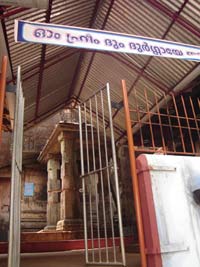
Kallil Bhagavathy temple or Kallil Kshetram, one among the famous cave temples in Kerala, is situated in Perumbavoor at a distance of 22kms from Kalady and 53 kms from Ernakulam respectively. Believed to be 1500 years old, this temple located on a 30 acre hillock is cut from a huge rock and can be reached by climbing 120 steps. A single rock acts as the roof of the temple and only an edge of the rock has touched the ground. The sanctum sanctorum (sreekovil) of the temple is under this rock.
Apart from the main deity Goddess Durgadevi, Lord Brahma, Shiva and Vishnu are also worshiped here. Daily rituals of the temple are completed before noon and it closes after the ucha (afternoon) pooja. Evening poojas are done only during the festival days. The Annual temple festival which lasts for eight days is celebrated in Vrischikam (November-December). During the festival days, a procession  carrying the idol of the main deity on a female elephant is held.
Another interesting feature of the Kallil Bhagavathy Temple is that it is also perceived as a Jain place of worship. A statue of Jain Seer Vardhamanamahavira can be seen carved out on the roof rock.


It is believed that the idols seen there are of Jainatheertha Parswanathan, Mahaveer and Pathmavathi Davi. This temple Sree Kallil Bhagavathi Cave Temple Mathala is now considered as an Hindu temple - Sreeramadasamission Devasthanam.

‘Kallil’, the name itself signifies the uniqueness of the temple. Kallil temple may be the lone rock temple in the country with the Deity of Goddess Durga.

The rock is approximately 23M x 14M x 8M. The temple, located in a 30 acres hill, is cut from a huge rock and a climb of 120 steps to reach the temple. The temple was owned by the Kallil Pisharody family.


Friday, March 9, 2012

Iringole Kavu

Iringole Bhagavathi Kshetram
 

History

Kamsan imprisoned Devaki and Vasudevan due to the fear that their eigth son Sreekrishna who is to be born soon would be his terminator from the earth. In fear and fury he killed their sevan sons. Vasudevan decided to save his eigth son from the danger at any cost. The parents shifted baby Sreekrishna to Dhwaraka soon after he was born and placed another girl baby in the cradle. Kamsan decided to kill the girl baby too, yet realising she was not the eight son of Vasudevan. He lifted the baby furiously above his head,but miraculously the baby became a supernatural power and remained in the atmosphere as 'IRRINNOLE". Later this area was named as "IRINGOLE". It is believed that the gods and godessess surrounded the power in the forms of trees and plants. And later it is developed into a beautiful thick forests.


Location

Iringole kavu, a miniature forest, is located between Kuruppampady and Perumbavoor on Aluva – Munnar road, 48kms from Ernakulam (Cochin or Kochi). Those who come by bus can get down at Iringole post office stop, which is two km away from the Perumbavoor – Kuruppampady route. A 500 metre walk from the post office stop towards the south direction will guide you to the wonderful rare place of a temple in the tropical rain forest in the middle of a town. Nedumbassery is the nearest airport, which is 22 km away. Aluva and Ernakulam are the railway stations, which are 18 km and 42 km away respectively from Iringole.